Exact measurements right in the point cloud
Measure distances, heights, areas, volumes, angles and slopes directly in 3D space. Check existing conditions, determine quantities and monitor construction states based on real 3D laser scanning data.
Analyze and measure point clouds from 3D laser scanning right in the browser and use them across projects.
A point cloud is the digital representation of a real object or terrain, created through high-precision 3D laser scanning. Millions of individual measurement points capture buildings, objects or infrastructure with millimeter accuracy, producing a faithful digital image of the actual as-built situation.
buck Vermessung captures this data using 3D laser scanning or complementary drone surveying, creating a dependable basis for planning, analysis and documentation. The acquired 3D laser scanning data is processed in a structured way and made available in Orbit as a browser-based point cloud viewer.
Point clouds can thus be viewed, measured and interactively analyzed online – right in the browser and without additional or costly specialist software.
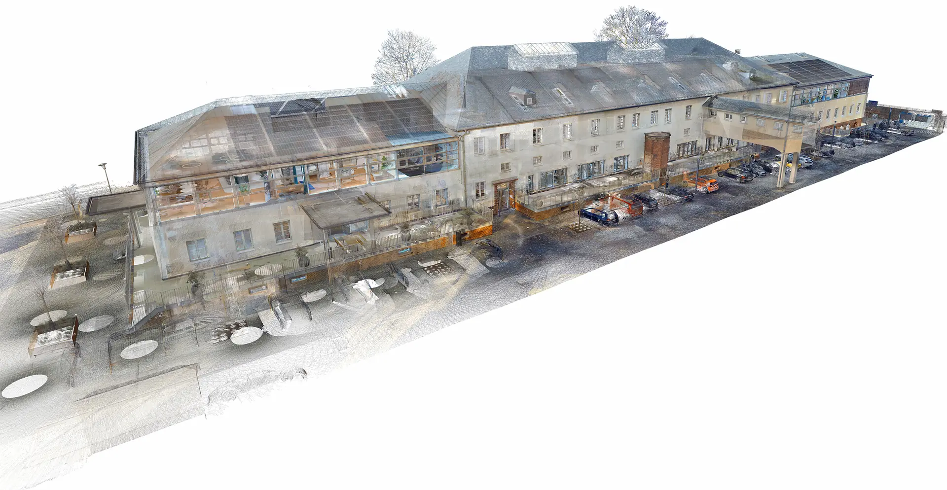
Even extensive point clouds with millions or billions of measurement points render smoothly and reliably in Orbit. The 3D laser scanning data captured by buck Vermessung is intelligently processed and loaded directly in the browser through a viewer – no separate installation required for analysis and measurement.
You need no separate desktop software and usually no particularly powerful computer. Even large datasets stay manageable, quick to use and interactively analyzable at any time – in the office, on site or on the go.
Orbit gives you browser-based point cloud software that lets you use point clouds from 3D laser scanning right in the browser. As a powerful point cloud viewer, Orbit makes it possible to view point clouds online, analyze them interactively and evaluate them precisely – entirely without additional specialist software.
Measure distances, heights, areas, volumes, angles and slopes directly in 3D space. Check existing conditions, determine quantities and monitor construction states based on real 3D laser scanning data.
Create horizontal or vertical sections directly from the point cloud. Ideal for route planning, terrain evaluation or documenting elevation profiles.
Show or hide areas selectively and reduce complex datasets to the relevant zones. Keep the overview and stay focused even on large projects.
Visualize your point cloud by RGB color, elevation, intensity or classification. Differences, structures and terrain forms become instantly recognizable and easier to interpret.
Place markers, comments and notes directly in the model. This simplifies project coordination, review processes and communication with clients, planners or authorities.
Alongside the data captured by buck Vermessung, existing point clouds can also be integrated and managed in a structured way.
Orbit bundles all captured survey data in one central project environment.
Structured 3D models, clearly presented and centrally available in the browser.
View 3D modelsThe quality of a point cloud starts with the survey. buck Vermessung captures your projects with state-of-the-art 3D laser scanning technology and provides the data in Orbit in a structured way.